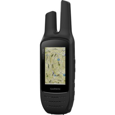
Garmin® Rino 755T
Submitted 7 years 8 months ago by feeds_user.
Description:
Garmin® Rino 755T
3” glove-friendly, sunlight-readable touch-screen display
Sensitive GPS/GLONASS receiver finds your position
Radio with up to two-mile (FRS) or 20-mile (GMRS) range
TOPO U.S. 100K maps and BirdsEye Satellite Imagery
Three-axis electronic compass and barometric altimeter
Rugged IPX7 waterproof housing withstands the elements
Unique Position Reporting sends your location to other users
Bluetooth capability and wireless sharing between Garmin units
Integrated NOAA weather radio
With a two-way radio, touch-screen GPS, three-axis electronic compass and barometric altimeter, Garmin's Rino 755T is your go-to tool for backcountry communication and navigation. Pre-loaded with Topo U.S. 100K maps and a one-year subscription to BirdsEye Satellite Imagery so you can easily get an idea of the lay of the land. High-sensitivity GPS/GLONASS receiver quickly finds your position and keeps it, even in dense cover. 3" sun-readable, touch-screen display with landscape and portrait orientation. Waterproof housing boasts a rating of IPX7 that ensures Mother Nature's worst elements can't disable it. Three-axis tilt-compensated compass with accelerometer and altitude-sensitive barometer. Active Weather shows you forecasts with animated radar and alerts you to inclement weather so you stay informed on the trail. Built-in Bluetooth® allows communication through your wireless headset. Share tracks, waypoints, geocaches and more with wireless sharing between Garmin GPS units. Garmin Connect™ automatically uploads software updates when online. Connect IQ™ lets you customize apps and widgets. Unique Position Reporting capability lets you send your exact location to other Rino users so they can see it on their map – perfect for group adventures. Unit-to-unit text messages let you share waypoints, tracks, routes and geochaches. Capture your adventure with the auto-focusing 8MP camera with LED flash/torch. Built-in NOAA weather radio keeps you in the know. Supports BirdsEye Satellite Imagery and includes one-year subscription. Micro-SD card slot makes adding more maps a breeze. Rechargeable lithium-ion battery delivers up to 14 hours of runtime. 5-watt transmitter power delivers a two-mile radio range over FRS and up to 20 miles over GMRS. Vibration mode. Includes worldwide basemap. USB and NMEA 0183 compatible.
7.5"H x 2.4"W x 1.8"D.Wt: 12.3 oz. with battery.
Store Name:
Price:
$519.99

